GoWeatherRadar: The Ultimate Guide to Best Weather Radar Website
Finding a reliable tracking map is surprisingly hard when sudden storms hit. Most platforms either lag or hide essential features behind clunky menus. If you are searching for the best weather radar websites, this guide breaks down what to look for and why GoWeatherRadar offers the fastest real-time updates. Read on to master your local forecast today!
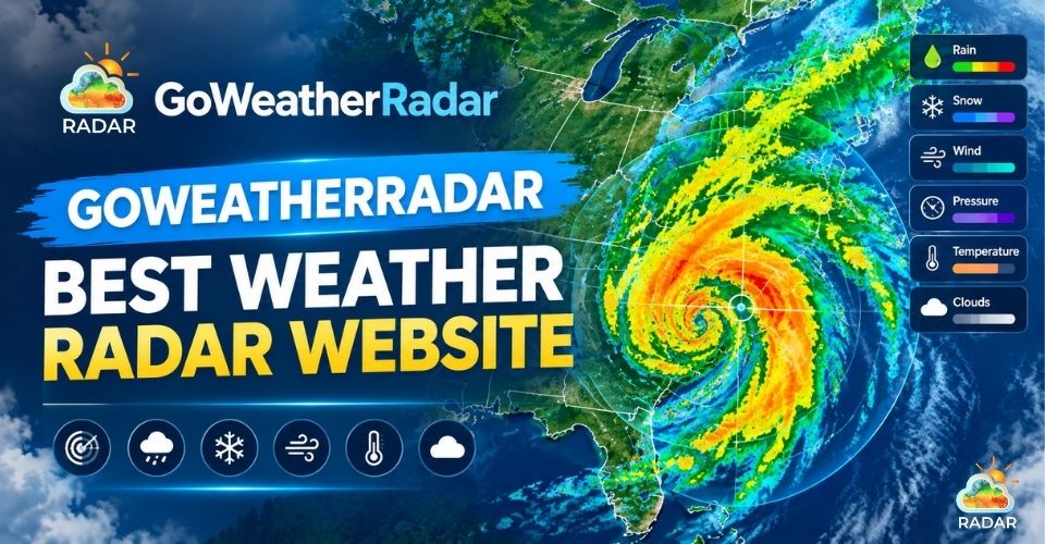
Best weather radar website
Best Weather Radar Website: What to Look For?
With dozens of live weather radar websites available online, choosing the right tool comes down to how quickly and reliably it helps you make decisions.
A high-quality weather radar platform needs to deliver performance, clarity, and precision.
Here are the essential criteria every top-tier weather radar website should meet:
-
Accurate and Frequently Updated Radar Data: Weather shifts in minutes. Superior sites pull live telemetry directly from national radar networks, updating every few minutes so you never get caught off-guard.
-
Interactive Weather Radar Maps: Fluid zooming and smooth panning down to street level allow you to track storm trajectories effortlessly across local towns or whole continents.
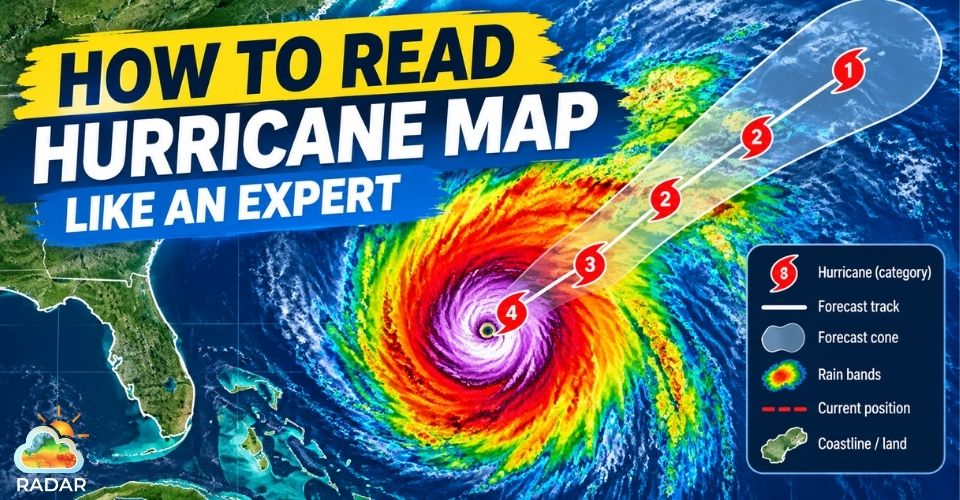
If you're following severe tropical storms, learning how to read a hurricane map can help you properly interpret track cones and wind radii.
-
Multiple Weather Layers: Beyond basic precipitation, a complete map lets you toggle layers for wind gusts, cloud cover, humidity, temperature, and atmospheric pressure.
-
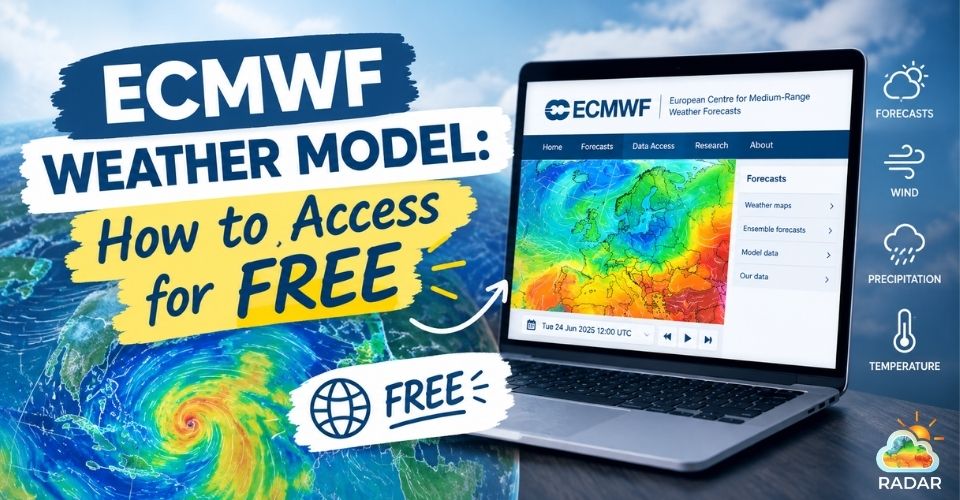
Forecast Data & Weather Models: Live radar shows current conditions, but integrated global models, like the ECMWF help you predict what is coming next over the coming hours and days.
-
Easy-to-Read Maps & Flexible Settings: Advanced data should be easy to read. Look for clear color scales and full control over measurement units (°C/°F, mph/km/h), time zones, and languages.
Finding the best weather radar website that offers high-resolution data, global forecast models, and effortless navigation feel impossible.
That is where the “All-in-One” GoWeatherRadar bridges the gap!
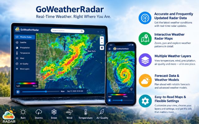
Must-have features of a live weather radar website
GoWeatherRadar - Best Option for Daily Weather Tracking
When tracking live precipitation or planning around sudden weather shifts, you need a tool that delivers instant clarity without hidden fees or complex setups.
GoWeatherRadar stands out as the best weather radar website designed to make atmospheric monitoring fast, intuitive, and accessible to everyone.
About GoWeatherRadar
GoWeatherRadar is a free web-based platform delivering high-resolution radar visualization and short-to-medium-range forecasts right in your browser.
It aggregates live telemetry and numerical prediction models onto a single interactive canvas, making it easy to track real-time rainfall, moving storms, temperatures, and wind patterns.
Built for daily planners, commuters, and outdoor enthusiasts, GoWeatherRadar bridges the gap between complex meteorological tools and everyday usability with a fast, clutter-free interface.
Explore its key features below to see how it can simplify your daily weather checks:
FREE-LIVE-INTERACTIVE Weather Radar Map
At the heart of GoWeatherRadar is a fully interactive canvas that updates continuously to reflect changing weather conditions.
You can pan smoothly across regions, zoom in to neighborhood street levels, and hit play on animated loops to observe how storm cells are moving in real time - all completely FREE.
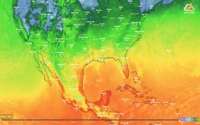
Tracking live precipitation and storm movements on GoWeatherRadar
Multiple Weather Conditions in ONE Map
Rather than forcing you to jump between different pages or apps, GoWeatherRadar consolidates major atmospheric parameters onto a single interactive map.
You can easily toggle between key weather layers:
-
Rain & Precipitation
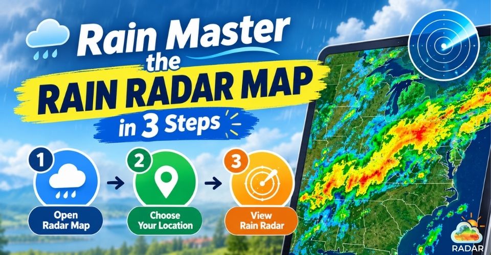
Monitor active rainfall and see how precipitation is distributed across your area.
The rain layer uses color-coded visuals to help you quickly identify areas of lighter or heavier precipitation and follow changing rain patterns.
You can also use the map to observe rain and thunder activity and precipitation accumulation over time.
⟶ Read more: Rain radar map
-
Snow
Track areas experiencing or expecting snow and monitor how winter precipitation is distributed across the map.
The snow layer helps distinguish snowfall conditions from other forms of precipitation, making it useful for checking winter weather across a wider region.
You can zoom in or out to follow changing snow patterns around your location.
⟶ Read more: Snow radar map
-
Wind & Temperature
See wind speeds, airflow patterns, and gust activity while comparing them with temperature conditions on the same map.
The wind layer helps you understand how air is moving across an area, while the temperature layer highlights warmer and colder zones through visual gradients.
Together, these layers can make it easier to assess changing conditions before traveling or spending time outdoors.
⟶ Read more: Wind radar map
-
Pressure
Identify high and low pressure areas that influence broader weather patterns and approaching fronts.
The pressure layer uses visual indicators and pressure values to help you recognize areas associated with more stable or unsettled conditions.
Comparing pressure patterns with rain and wind layers can provide additional context for understanding developing weather systems.
-
Humidity & Clouds
Assess moisture levels and cloud coverage to get a better picture of the atmosphere beyond temperature and precipitation alone.
The humidity layer shows moisture patterns across your selected area, while the cloud layer helps visualize cloud coverage and movement.
Together, they can provide useful context for identifying increasingly humid, cloudy, or potentially rainy conditions.
⟶ Read more: Humidity radar map
⟶ Read more: Cloud radar map
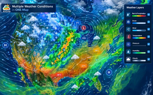
Toggling between rain, wind, temperature, and cloud overlays
Powered by ECMWF Forecast Model
To deliver trustworthy predictive data alongside live radar, GoWeatherRadar incorporates the European Centre for Medium-Range Weather Forecasts (ECMWF) model.
Meteorologists worldwide widely regard the ECMWF weather model as the gold standard in numerical weather prediction.
-
9 km High-Resolution Grid: The platform utilizes ECMWF’s high-resolution global grid (~9 km resolution), capturing subtle terrain influences and localized atmospheric variations that coarser models miss.
-
Short & Medium-Range Forecasting: GoWeatherRadar extends beyond live tracking by leveraging ECMWF data to provide reliable hourly and daily forecast projections.
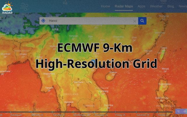
GoWeatherRadar leverages 9 km high-resolution ECMWF model data
Highly Customizable Weather Settings
GoWeatherRadar ensures that data is always presented in the format you prefer.
Through a quick settings menu, you can fully adapt the map interface to match your local standards or personal preferences:
-
Temperature: Switch seamlessly between °C and °F.
-
Wind Speed: Select mph, km/h, m/s, or knots.
-
Precipitation: Measure rain and snow in mm or inches.
-
Pressure: Toggle between hPa, inHg, or mmHg.
-
Distance: Set preferred map scales in kilometers or miles.
-
Time & Timezone: Choose 12-hour or 24-hour display formats aligned with your local time zone.
-
Language: Adjust regional language preferences for seamless global usability.
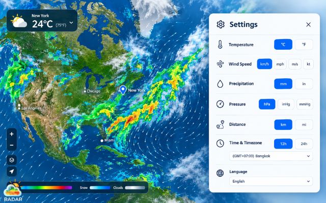
Personalizing measurement units, time formats, and display languages
More to explore
Why Use GoWeatherRadar for Everyday Weather Monitoring?
While professional meteorology tools cater to researchers and storm chasers, daily life demands quick, actionable answers.
GoWeatherRadar simplifies atmospheric tracking into an effortless daily routine, giving you instant clarity whenever weather decisions arise.
Here is why thousands of users rely on GoWeatherRadar as the best weather radar website for their day-to-day weather checks:
-
Lightning-Fast Weather Checks: Skip bloated apps and heavy ad banners. GoWeatherRadar loads instantly on web browsers and mobile screens, letting you view real-time radar conditions within seconds.
-
Plan Outdoor Activities with Confidence: Whether heading out for a morning run, commuting to work, or setting up a weekend barbecue, check live precipitation radar loops to decide if you need an umbrella or can leave the raincoat behind.
-
Track Shifting Precipitation Live: Rain cells and winter storms move dynamically. The interactive map lets you monitor active storm direction, intensity shifts, and approaching rain fronts in real time so you are never caught off-guard by a sudden downpour.
-
Get a Comprehensive Picture of Local Conditions: Zooming out provides crucial context. Rather than relying solely on a single temperature number, observe surrounding pressure centers, wind currents, and cloud formations driving localized atmospheric changes.
-
Monitor All Parameters in One Consolidated Map: Say goodbye to toggling across multiple weather sites. GoWeatherRadar layers live radar, ECMWF forecasts, temperature fields, humidity, and wind dynamics into one unified, easy-to-use platform.
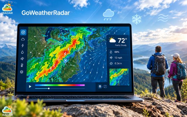
Using GoWeatherRadar for quick daily checks to monitor weather changes
Pro Tips: How to Get More From a Weather Radar Website
Basic radar checks tell you if it is currently raining, but knowing how to interpret advanced map layers can give you a major advantage when planning around unpredictable weather.
Here is how to maximize the value of the best weather radar website:
-
Combine Radar With Forecast Information
Radar shows live physical observations (what is happening right now), while numerical models like ECMWF project upcoming trends.
Cross-reference live radar movement with 3-hour or 6-hour forecast timelines to see whether an approaching rain front will intensify or dissipate before arriving.
-
Compare Different Weather Conditions
ain rarely happens in isolation. Switch between different parameter overlays to understand the broader atmospheric engine.
Overlaying wind patterns shows where air masses are driving storm fronts, while checking atmospheric pressure helps identify approaching low-pressure systems that bring sustained rain.
-
Use Official Alerts for Severe Weather
During extreme conditions like severe thunderstorms, flash floods, or winter blizzards, use interactive radar alongside official weather warnings issued by national meteorological agencies (such as NOAA or NWS).
Radar gives you spatial visibility, while official advisories provide safety protocols and local emergency guidance.
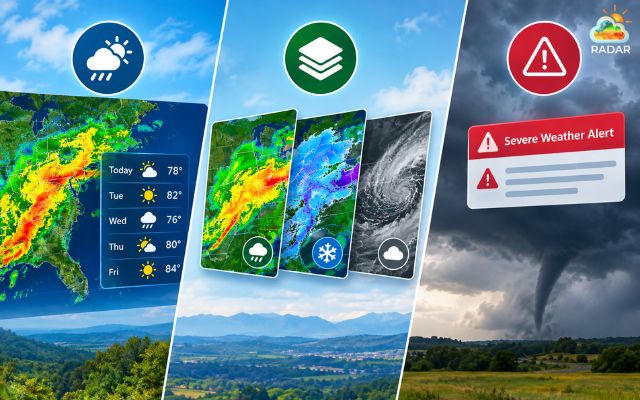
Combining live weather radar with official weather alerts from meteorological agencies
For official government emergency data within the U.S., NWS Radar (NOAA) provides raw, uncompressed NEXRAD observations.
GFS (US Global Forecast System) provides strong global coverage and long-range projections, but ICON often outperforms it in capturing complex terrain dynamics and short-range precipitation events.
Sum up
Finding the best weather radar websites comes down to speed, accuracy, and clear map visuals. While traditional tools can feel cluttered, GoWeatherRadar simplifies live storm tracking with high-resolution ECMWF forecasts and intuitive multi-layer overlays. Whether dodging a afternoon shower or tracking major precipitation fronts, visit GoWeatherRadar today for instant, real-time weather insights you can trust!


0 Comments
Leave a Comment
Your email address will not be published. Required fields are marked *