Weather Radar for Cycling: How to Track Rain, Wind, and Storms on Every Ride
Whether sudden downpours or harsh headwinds threaten your route, a reliable weather radar for cycling is key to a safe ride. This guide breaks down the top features to look for and shows how GoWeatherRadar keeps you one step ahead of storms. Dive in to master route planning and ride with total confidence!
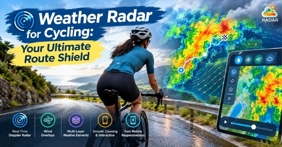
Weather radar for cycling
Essential Features in a Weather Radar for Cycling
Standard forecasts tell you if it might rain today in your city, but cyclists need to know exact timing, storm intensity, and wind behavior along a specific route.
Here are the non-negotiable features every cyclist should look for in a weather radar:
-
Real-Time Doppler Radar: Storms move quickly. High-frequency updates - refreshing every few minutes let you pinpoint incoming rain cells down to the minute and street level.
-
Wind Overlays: Wind can transform an enjoyable ride into a grueling battle. Visualizing wind vectors helps you plan routes to take advantage of tailwinds or avoid severe headwind cross-sections.
-
Multi-Layer Toggle (Rain, Clouds, Temperature, Pressure): Precipitation is only part of the story. Being able to switch layers, from cloud cover and humidity to atmospheric pressure, helps you spot sudden squall lines or drastic temperature drops early.
-
Smooth Zooming & Interactive Maps: Quick panning and street-level zooming let you track rain clusters along your exact GPX route or coffee stop.
-
Fast Mobile Responsiveness: On-the-go checks require a clean interface that loads instantly without lagging, even on weak cellular networks.
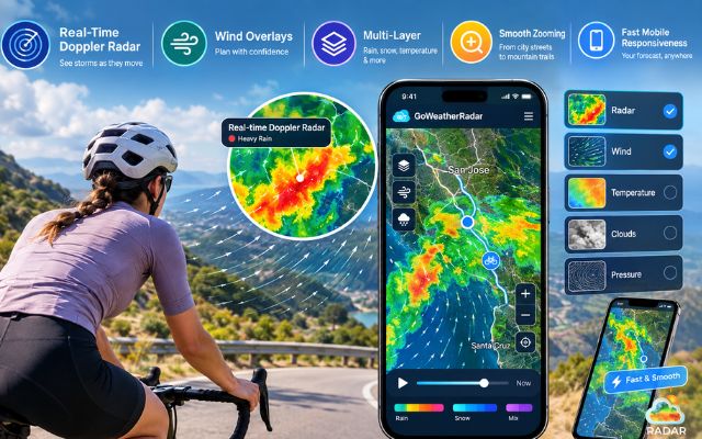
Key features in a weather radar for cycling
Discover more
- Weather radar for boating
- Weather radar for driving
Why Cyclist Loves GoWeatherRadar
When you are out on the open road, you need instant answers without wading through paywalls or heavy ads.
GoWeatherRadar stands out as an essential tool built for outdoor enthusiasts and daily ride planners alike.
Here is why cyclists trust GoWeatherRadar for every trip:
1. Powered by the ECMWF Models
GoWeatherRadar integrates live radar feeds with data from the European Centre for Medium-Range Weather Forecasts (ECMWF).
Renowned as the most accurate global forecast model, ECMWF ensures your short-term nowcasting and multi-day ride planning are grounded in reliable data.
Learn why ECMWF is considered “gold standard” weather model!
2. All Essential Cycling Layers on One Screen
Instead of switching between multiple weather apps, GoWeatherRadar consolidates every parameter into one seamless interactive map:
-
Rain / Precipitation Layer: Track light drizzle versus heavy convective downpours using an intuitive color scale.
-
Wind Dynamics: View real-time wind speed and flow directions to optimize your energy output.
-
Cloud & Humidity Index: Monitor cloud density to avoid harsh sun exposure or prepare for sudden mountain fog.
3. Highly Customizable Units for Cyclists
Tailor your weather dashboard to match your bike computer's metrics:
-
Wind Speed: Toggle between mph, km/h, m/s, or knots.
-
Temperature: Switch easily between °C and °F.
-
Precipitation: Measure rainfall in mm or inches.
4. 100% Free & No Registration Needed
Subscription fees and locked features can disrupt your route planning.
GoWeatherRadar offers full access to its high-resolution live radar, wind vectors, and extended forecasts completely free - straight from your mobile browser or device.
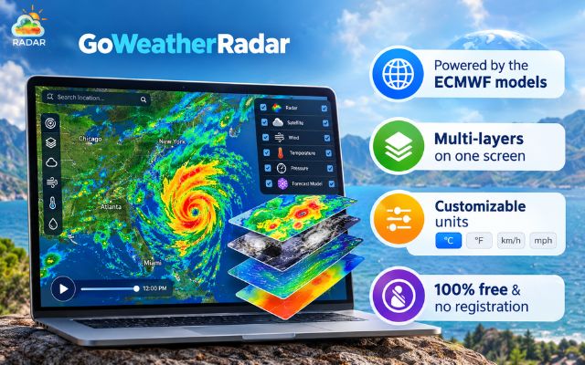
GoWeatherRadar is an ultimate tool for cyclists
Step-by-Step Guide on Using GoWeatherRadar for Cycling
Here is how you can use the live radar map to outsmart unpredictable weather and keep your rides smooth:
Step 1: Open the Live Radar Map
Before putting on your cycling shoes, open your browser and navigate to the Live Radar Map page.
The map automatically detects your current location or lets you search for your planned riding destination using the search bar at the top.
Step 2: Check the Rain & Precipitation Layer
Look at the default Rain view to spot immediate storm clusters.
The color-coded scale shows precipitation intensity - green indicates light showers, while yellow, orange, and red signal heavy downpours or thunderstorms.
Use the timeline at the bottom to animate cloud movement over the past hours and see where the storm is headed.
Step 3: Switch to the Wind Layer to Plan Your Route
Click on the layer selector menu on the right side of the screen and select Wind.
The map displays animated wind flow lines alongside real-time speed data.
Use this feature to map out your course - plan to ride into a headwind early while your energy is fresh, and enjoy a supportive tailwind on your way back.
Step 4: Adjust Measurement Units to Match Your Cycling Computer
Ensure your weather metrics align with your bike unit (such as Garmin or Wahoo). Open the settings icon to customize units:
-
Wind Speed: Set to km/h or mph.
-
Temperature: Choose between °C or °F.
-
Precipitation: Toggle between mm or inches.
Step 5: Bookmark for Quick Mid-Ride Checks
Save the radar map page to your smartphone’s home screen or browser bookmarks.
During coffee breaks or rest stops along your route, pull up the map for a 10-second check to confirm clear skies ahead before unclipping and rolling out.
Did you know that GoWeatherRadar is not only ideal for cycling? Discover more weather radar applications of GoWeatherRadar here!
|
Quick Tips for Cyclists Facing Unpredictable Weather
|
Sum up
Choosing a reliable weather radar for cycling is the smartest way to protect your rides from sudden storms and harsh headwinds. By checking live Doppler maps and wind layers on GoWeatherRadar, you can plan every route with complete confidence. Check the radar before your next trip and enjoy smooth, dry rides!


0 Comments
Leave a Comment
Your email address will not be published. Required fields are marked *