Record-Early Polar Vortex Split Forecast Points to Historic Stratospheric Warming in November
The polar vortex split forecast is drawing attention as atmospheric conditions over the Arctic show signs of an unusually early breakdown. Forecast models point to a possible disruption in early November 2026. However, the developing Super El Niño could complicate its effects, leaving much of the United States warmer than expected.
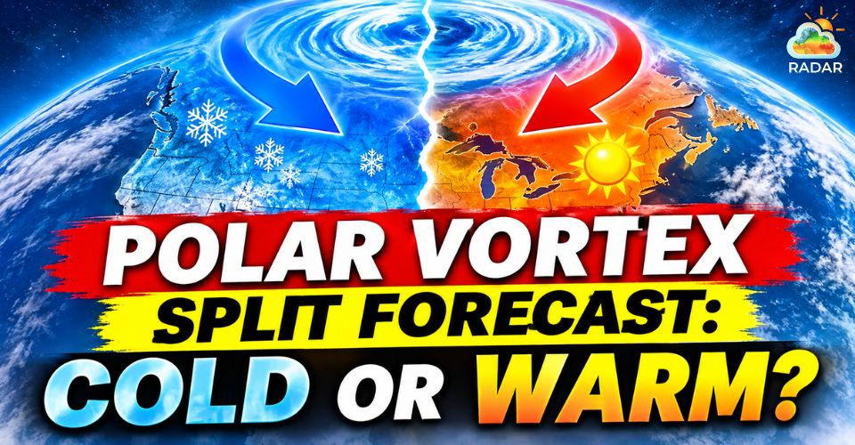
Polar vortex split forecast
Polar Vortex Split Forecast Points to Record-Early Disruption
A major change in the Arctic stratosphere could develop around November 8, 2026, according to recent forecast models.
The potential event would involve a sharp weakening of the polar vortex, with some projections indicating that its surrounding winds could reverse direction.
The polar vortex is a broad circulation of strong winds that keeps extremely cold air concentrated around the Arctic during winter.
When this system weakens, warmer air can move into the stratosphere, disturbing its normal circulation. This process is known as Sudden Stratospheric Warming (SSW).
In a more significant disruption, the vortex can become stretched or divide into two separate circulation centers.
Such a split may change the movement of cold air across the Northern Hemisphere, although the effects depend on how the atmosphere responds afterward.
|
🧊 Polar Vortex |
☀️ Sudden Stratospheric Warming (SSW) |
|
A strong high-altitude wind ring trapping cold Arctic air at the pole. |
A rapid, dramatic temperature spike in the polar stratosphere. |
|
Acts as a natural fence keeping frigid air confined to high latitudes. |
Planetary waves push heat upward, disrupting polar wind patterns. |
|
When split, icy polar air spills south into North America & Europe. |
Serves as the main trigger that collapses or splits the polar vortex. |
The timing is particularly notable.
Major disruptions usually occur during the heart of winter, rather than in early November.
If the current projections verify, this could be the earliest major disruption in the historical record, surpassing the previous November 28, 1968 milestone.
Forecast guidance from ECMWF and GEFS points to weakening stratospheric winds during the first part of November.
However, the projected reversal and potential split remain forecast scenarios, not confirmed observations.
Polar Vortex Disruption May Not Bring Immediate US Cold
An unusually early disruption does not necessarily mean that freezing conditions will spread across the United States.
According to the latest polar vortex split forecast, changes high in the stratosphere need time to influence the lower atmosphere, where most weather systems develop.
Meteorologists expect any potential surface impacts to take several weeks to emerge.
This places late November and December within the period to watch for possible changes in the jet stream and southward-moving Arctic air.
For now, the coldest air is expected to remain concentrated over parts of Eastern Europe and Siberia.
Meanwhile, the latest US temperature outlook favors warmer-than-average conditions across the Pacific Northwest, Northern Plains, Upper Midwest, Great Lakes and Northeast.
Super El Niño could help maintain this mild pattern.
The climate phenomenon typically strengthens the Pacific jet stream, allowing milder air from the Pacific to move into parts of North America.
This circulation may limit how long Arctic air can remain over the central and northern United States.
|
Period |
Potential development |
|
November 6–10, 2026 |
Stratospheric winds could weaken significantly or reverse direction. |
|
Mid-November |
The atmospheric response may continue developing. |
|
Late November |
Changes in the jet stream could become more noticeable. |
|
December 2026 |
Some regions may experience colder conditions or Arctic air intrusions. |
|
Winter 2026–2027 |
The interaction between the polar vortex and Super El Niño could shape broader temperature patterns. |
Residents in Chicago can check precipitation, snowfall and wind conditions on Radar Map to follow approaching weather systems and potential changes in local conditions.
Winter Could Bring a Battle Between Cold and Warm Patterns
Despite the warmer outlook, the possibility of colder weather later in the season has not disappeared.
The interaction between the disrupted polar vortex and Super El Niño could produce a changeable winter, with periods of mild weather interrupted by occasional cold-air intrusions.
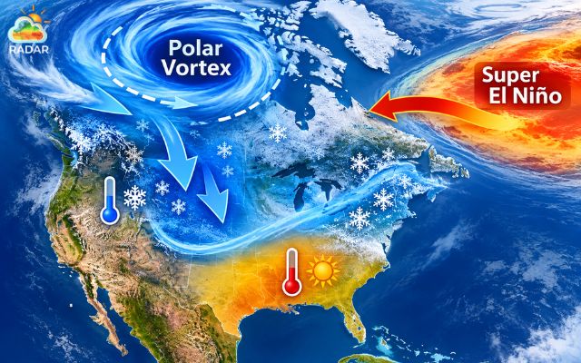
Interaction between the polar vortex and El Niño may create contrasting weather patterns
Historical analysis from Severe Weather Europe provides another perspective.
Researchers examined thousands of climate simulations and identified 21 winters with atmospheric and oceanic conditions similar to those currently developing, including an early polar vortex collapse, strong El Niño and westerly QBO.
These historical cases showed colder temperature signals extending from western Canada into parts of the United States.
They also indicated greater snowfall potential across portions of the northern and eastern US.
However, these comparisons should not be treated as a direct prediction for the upcoming winter.
Each season develops differently, and the strength and timing of the atmospheric response remain uncertain.
The key question is whether the weakened polar vortex will eventually push enough Arctic air southward to overcome the warmer influence of Super El Niño.
For now, forecasters are watching how the stratospheric circulation evolves.
Updated models over the coming weeks should provide a clearer picture of whether this record-early disruption will have a meaningful impact on US winter weather.
References
-
FOX Weather
-
USA Today
-
KFI
-
Severe Weather Europe




0 Comments
Leave a Comment
Your email address will not be published. Required fields are marked *