Tropical Depression Nine Forms in Atlantic, Threatening Gulf Coast with Flood Risks
Tropical Depression Nine is gaining strength over the Gulf of America as forecasters watch its potential path toward the U.S. Gulf Coast. The system could develop into Hurricane Isaias later this week. Heavy rainfall, flash flooding and thunderstorms may affect parts of the Southeast. Louisiana, Mississippi, Alabama and the Florida Panhandle are among the areas being monitored. Here’s what to know.
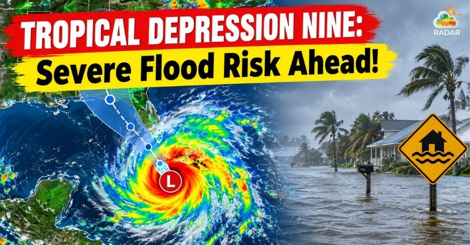
Tropical Depression Nine is intensifying along the Gulf of America
Tropical Depression Nine Gains Strength Over the Gulf
Tropical Depression Nine developed off the Mexican coast in the Gulf of America on October 6. Since then, the system has shown signs of becoming more organized as it moves slowly across the Gulf.
The depression has maximum sustained winds of about 35 mph. It is currently traveling eastward at roughly 5 mph.
At this stage, the system remains below the 39-mph threshold required for tropical storm status.
The National Hurricane Center expects the depression to strengthen into a tropical storm on Wednesday.
If that happens, it will be given the name Isaias.
Forecasts indicate that additional strengthening could follow, with the system potentially reaching Category 2 hurricane strength by Friday night.
Winds could approach 100 mph if the system reaches that intensity.
However, the exact strength will depend on how quickly the circulation becomes organized and how environmental conditions change.
Very warm water across the Gulf could help fuel further development. Current Gulf sea surface temperatures are at their highest levels in records dating back to 1982.
Warm ocean water provides heat and moisture that can support tropical systems as they strengthen.
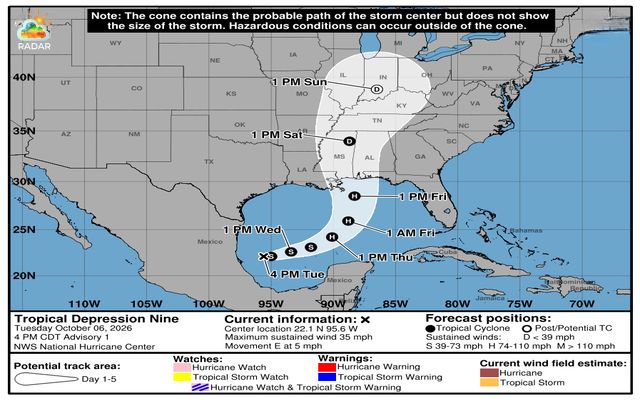
Tropical Depression Nine forecast (NOAA)
Before the storm approaches, use GoWeatherRadar’s radar map to monitor rainfall and changing conditions around Louisiana.
Tropical Depression Nine Could Move Toward the Northern Gulf Coast
Forecast guidance shows Tropical Depression Nine moving generally eastward before making a turn toward the northeast.
The system is expected to pass north of the Yucatán Peninsula on Thursday. It could then head toward the northern Gulf Coast by Friday.
Louisiana, Mississippi, Alabama and the Florida Panhandle are currently among the areas that could see impacts.
The exact location and timing of those impacts remain uncertain because the system is still developing.
A storm forecast cone should also be interpreted carefully. It represents the expected range for the center of the system, rather than the full area that could experience dangerous weather.
Rain, strong winds and thunderstorms can spread far beyond the projected centerline.
This means communities outside the center of the forecast path should not assume they are out of danger.
Changes in the storm’s speed, direction or intensity could also shift the areas at risk.
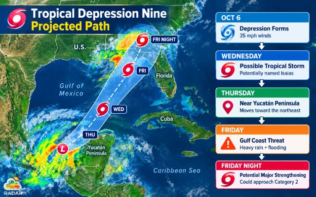
Projected path of Tropical Depression Nine
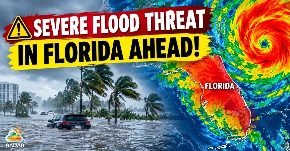
Flash Flood and Severe Weather Concerns Are Growing
Heavy rainfall could become one of the most significant threats from the developing system.
The Weather Prediction Center has placed parts of the Southeast under a Level 2 of 4 excessive rainfall risk for Friday and Saturday.
Several inches of rain could fall across areas near the storm’s projected route. Southeastern Louisiana through the Florida Panhandle may be among the areas that receive the heaviest rainfall.
Flooding could become more likely where the ground is already saturated. Intense downpours may quickly overwhelm drainage systems and cause streams and rivers to rise.
Low-lying communities could face particularly difficult conditions.
The threat is not limited to rainfall. Moisture from the tropical system could combine with other weather features and support stronger thunderstorms as it moves inland.
These storms may bring damaging winds, frequent lightning and bursts of intense rain.
The broader Southeast and parts of the Southern Plains could also see weather impacts as tropical moisture spreads across the region.
Recent forecasts have highlighted the potential for both heavy rainfall and severe thunderstorms.
Importantly, flooding does not depend on a direct landfall. Areas located well away from the storm’s center can still experience dangerous rainfall.
Residents should therefore watch local forecasts rather than relying only on the projected storm track.
|
🌧️ HEAVY RAIN |
Several inches possible |
|
🌊 FLASH FLOODING |
Level 2/4 risk |
|
⛈️ SEVERE STORMS |
Strong winds & lightning |
|
📍 WIDESPREAD IMPACTS |
Beyond storm center |
Residents across the Gulf Coast should continue following advisories from the National Hurricane Center and local emergency officials.
Those in flood-prone areas should prepare for heavy rain and review evacuation plans if needed.
Outdoor objects should be secured, while emergency supplies should be kept ready before conditions deteriorate.
Because Tropical Depression Nine is still evolving, its forecast track and strength may change in the coming days.
Stay informed with the latest weather news and forecasts from Weather365.
References
-
FOX Weather
-
The New York Times
-
Qazinform




0 Comments
Leave a Comment
Your email address will not be published. Required fields are marked *