Latest El Niño Update: A Powerful Event Shapes U.S. Winter Forecasts
The latest El Niño update points to a powerful Pacific warming event that could shape U.S. winter weather in 2026–2027. With conditions nearing their peak, several regions may face warmer temperatures, changing snowfall patterns, and increased rainfall.
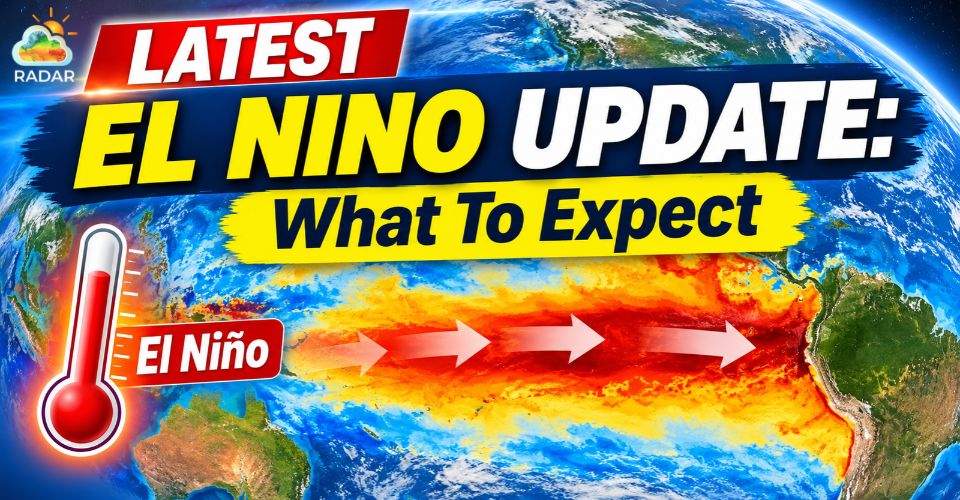
Latest El Niño update
Latest El Niño Update: Expected Timeline
|
Pacific Ocean Warming Keeps El Niño on Track for a Historic Event
El Niño is intensifying as unusually warm water spreads across the equatorial Pacific.
NOAA's Climate Prediction Center (CPC), in its November 12 update, reported that the Niño-3.4 index climbed to +2.5°C above average in October, compared with +2.1°C in September.
This measurement tracks sea surface temperatures in the central and eastern tropical Pacific and helps scientists assess the strength of El Niño.
Other indicators also point to significant warming, with the Niño-3 index reaching +3.6°C and the Niño-1+2 index rising to +4.4°C.
Despite these readings, the possibility of a record-breaking event has become less certain.
NOAA now estimates roughly a 60% chance that the Relative Oceanic Niño Index (ROnI) will reach the threshold associated with historic strength during October–December and November–January.
The previous estimates were higher.
Still, the broader outlook remains significant. NOAA sees more than a 79% chance of strong-to-very-strong El Niño conditions lasting through January–March 2027.
This means the event could have a substantial influence on global weather patterns even if it does not surpass previous records.
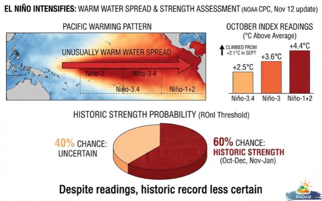
Rising sea surface temperature index readings in the Pacific
El Niño Could Reach Its Strongest Point Before Spring 2027
The latest experimental forecast from NOAA's Geophysical Fluid Dynamics Laboratory (GFDL), released November 16, suggests that El Niño has reached or is approaching its peak.
The event is expected to weaken gradually after reaching its strongest phase. However, the cooling process will likely take time, allowing El Niño conditions to remain in place throughout the 2026–2027 winter.
The transition toward EnSO-neutral conditions is more likely in late spring or summer 2027.
NOAA's November outlook gives a 61% probability of neutral conditions returning during April–June, while the chance of El Niño continuing stands at approximately 38%.
Forecast confidence generally decreases farther into the future.
Changes in ocean temperatures and atmospheric circulation could affect how quickly the Pacific pattern shifts.
For now, forecasters expect El Niño to remain an important climate influence during the coming winter.
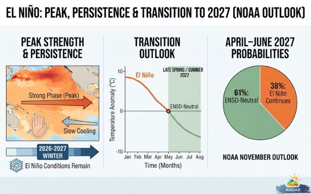
El Niño Peak & Transition to 2027
U.S. Winter Forecast: Warmer Temperatures, More Rain and Changing Snowfall
A strong El Niño can shift the jet stream and influence where storms develop and travel.
However, its effects will vary across the United States rather than producing the same conditions everywhere.
-
Northeast
Much of the region could experience above-average temperatures, potentially limiting snowfall in some areas.
Connecticut's latest seasonal outlook favors below-normal snowfall across much of the state, although the northwest hills could receive higher totals.
Current estimates range from 20–30 inches near Bridgeport to 35–50 inches around Hartford and 70–75 inches near Norfolk.
Individual snowstorms remain possible, especially when sufficient cold air is available.
-
Southeast and Eastern U.S
A more active storm track could increase opportunities for rainfall across parts of the South and East.
NOAA's seasonal outlook favors above-average precipitation along much of the eastern seaboard, with particularly strong wet signals across the Southeast and Florida.
Periods of heavy rain could raise localized flooding concerns.
-
Western U.S
California and parts of the Southwest also have an increased likelihood of wetter-than-average conditions.
More frequent Pacific storm systems could bring substantial rainfall and mountain snow, although the timing and location of individual storms remain uncertain.
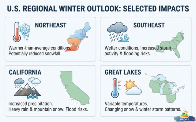
US Regional winter outlook
For real-time precipitation activity around Connecticut, check the weather radar on Radar Map to monitor approaching rain and snow systems.
Overall, El Niño offers an important signal for the 2026–2027 winter, but it cannot determine the exact weather in any city.
NOAA's next seasonal outlook, scheduled for November 19, should provide further details as the winter season approaches.
References
-
NOAA
-
USA Today
-
Cleveland
-
CT Insider
-
BBC


0 Comments
Leave a Comment
Your email address will not be published. Required fields are marked *