Hurricane Polo Threatens Mexico and Triggers Heavy Flooding Across US Southwest
MEXICO CITY — Hurricane Polo experienced rapid intensification into a violent Category 5 storm off Mexico's Pacific coastline on Tuesday, generating sustained winds of 180 mph. Although the storm's center is tracking parallel to the coast without direct landfall, its outer bands are battering coastal towns with dangerous surf and torrential rain. See the latest updates from us below!
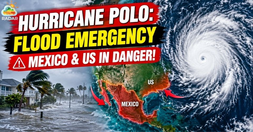
Hurricane Polo rapidly intensifies into a Category 5 storm
Hurricane Polo Strengthens Into Record-Breaking Pacific Monster
In less than 24 hours, Hurricane Polo transformed from a standard hurricane into one of the most powerful Pacific storms ever recorded.
The storm's sustained wind speed surged by 110 mph in a single day, achieving the second-fastest rate of rapid intensification documented in the Pacific ocean.
Aircraft measurements from Hurricane Hunters showed that Polo's central pressure dropped sharply to 892 millibars, ranking as the second-lowest pressure recorded in the eastern or central Pacific basin.
Meteorologists link this sudden surge in strength to elevated sea surface temperatures driven by a supercharged El Niño event across the Pacific ocean.
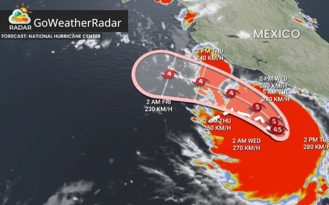
Hurricane Polo is moving fast off Mexico's coast (Source: The Weather Network)
Heavy Rain, Dangerous Waves, and Mudslide Risks
As Hurricane Polo sweeps along Mexico's west-central coastline, local authorities remain on high alert for severe weather hazards.
Tropical storm advisories stay in effect across coastal communities stretching from Tecpan de Galeana to Punta San Telmo and Playa Perula.
Torrential downpours from the storm's outer bands raise severe concerns for dangerous flash flooding and earth-slides in mountainous regions.
Heavy swells and destructive waves continue to impact popular coastal destinations, including Zihuatanejo and Acapulco.
Forecast models indicate Polo will turn northwest away from the immediate coast while gradually weakening as it moves toward Baja California later this week.
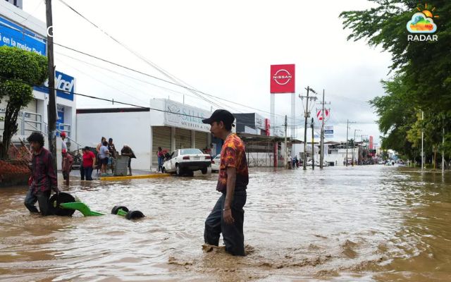
Mexico braces for heavy rain and flooding risk
Headed near Zihuatanejo or monitoring coastal weather conditions? Check live weather radar and precipitation intensity on GoWeatherRadar today.
Flash Flood Warnings & High Surf Alerts issued
While remaining hundreds of miles south of the U.S.-Mexico border, Polo is sending vast amounts of tropical moisture northward into monsoon weather systems across the U.S. Southwest.
According to the National Weather Service in Albuquerque, heavy rainfall presents a severe threat of life-threatening flash floods across major sections of New Mexico.
In Mora County, local officials declared a Flash Flood Emergency, deploying emergency teams for water rescues and mandatory evacuations.
High rainfall totals are also expanding across Arizona and major metropolitan areas including Roswell and Albuquerque.
Farther west, ocean swells produced by Polo are slamming Southern California beaches, creating high surf and hazardous rip currents from San Diego to Los Angeles.

Polo can bring life-threatening flash floods across major sections of New Mexico
Residing in or traveling through Albuquerque? Track real-time storm cells and live precipitation updates on RadarMap right now.
Polo is part of a broader pattern of active tropical weather across the Pacific basin. Forecasters are tracking Tropical Storm Odalys to the west, which could interact with Polo and influence its trajectory.
Furthermore, moisture remnants from other tropical systems continue to bring heavy rainfall to Hawaii, capping off a remarkably active Pacific storm season.
References
-
FOX Weather
-
AP News
-
CNN
-
Reuters
-
LA Times





0 Comments
Leave a Comment
Your email address will not be published. Required fields are marked *