Before-and-after Images of the LA Fires Reveal Their Terrible Scale
As mentioned earlier this week, wildfires force thousands of people in LA from their homes. Satellite images show the trail of damage caused by flames in Los Angeles and adjacent regions.
The fires have been blazing since Monday, destroying slightly over 11 square kilometers of the city.
Thousands of houses and structures have been destroyed, and citizens around the city have been evacuated as they continue to burn.
Satellite images from Maxar Technologies have caught the city's tremendous change in only a few short days, painting a gloomy picture of the authorities' remaining clean-up efforts.
Below are some before-and-after images showing the aftermath of the blazes, with houses and neighborhoods left completely destroyed.
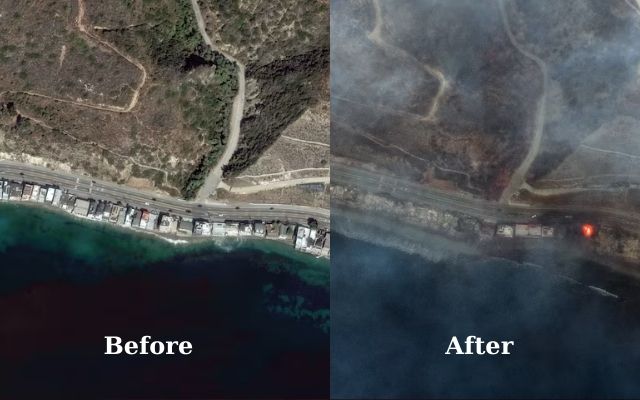
Tuna Canyon along the Pacific Coast Highway in California
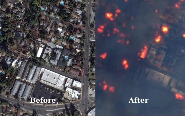
East Altadena Drive and buildings burning
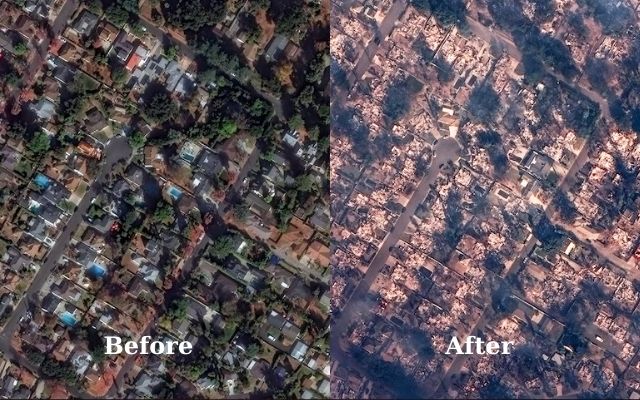
Houses along Marathon Road, Altadena
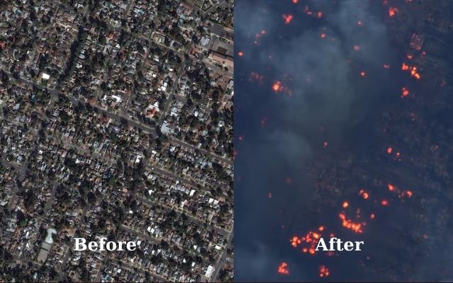
Houses near Fair Oaks Avenue, Altadena


0 Comments
Leave a Comment
Your email address will not be published. Required fields are marked *